


ste marguerite

cmike39
User
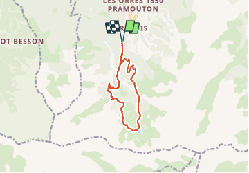

Length
11.4 km

Max alt
2272 m

Uphill gradient
635 m
Km-Effort
19.8 km

Min alt
1660 m

Downhill gradient
631 m
Boucle
Yes
Creation date :
2023-09-10 07:21:17.713
Updated on :
2023-09-10 13:38:19.061
3h09
Difficulty : Very difficult

FREE GPS app for hiking
 SityTrail
IGN / Geographical institutes
SityTrail Plus
The world is yours!
About
Trail Walking of 11.4 km to be discovered at Provence-Alpes-Côte d'Azur, Hautes-Alpes, Les Orres. This trail is proposed by cmike39.
Positioning
Country:
France
Region :
Provence-Alpes-Côte d'Azur
Department/Province :
Hautes-Alpes
Municipality :
Les Orres
Location:
Unknown
Start:(Dec)
Start:(UTM)
305200 ; 4928634 (32T) N.
Comments